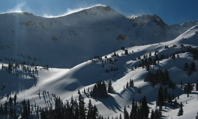
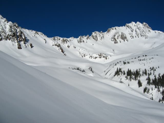
Alpine lakes, high traverses, and 13,000-foot ridgelines — all starting at the front door.
Old mule trails left from the days of hardrock mining offer adventurous explorations around the hut, many of which do not show on popular maps. Many trail loops leave right from the back door of the hut. There are four alpine lakes within two miles of the OPUS, and more a little further out — great for an afternoon dip or fishing at Crystal Lake, Clear Lake, or Island Lake. Off trail, above treeline, endless meadows of alpine wildflowers beckon, with peak blooms from the end of June into early August.
Our interactive map shows the various hiking trails around the OPUS — clicking on a segment will give you distance and elevation.
The classic day out: about 4.6 miles each way along the Treeline Traverse to an impossibly turquoise lake. From the hut, descend through open meadows of wildflowers and cross the open bowl (“The Sound of Music”), then pick up the four-wheel-drive road for 500 feet before leaving it on single track. The trail traverses east at treeline (11,800 ft.), crossing the Ruby Creek drainage and two open avalanche slide paths. Past the big meadows, follow cairns northwest over a small ridge on a game trail, climbing about 200 vertical feet, then drop into the Columbine Lake trail just above treeline and follow it up to the lake.


A short, adventurous walk to a hidden lake that isn't labeled on the maps. From the hut, follow the faint trail east — marked with cairns and orange marker flags — onto grassy south-facing slopes, turning around the ridge and traversing above a small cliff band to a bench. From the bench, climb the old mule trail 400+ feet to the south side of Ruby Lake, tucked in its own small basin below Columbine Pass.
Note: above Ruby Lake, a slippery game trail climbs to the col that connects over to Columbine Lake. The route is steep and very loose, and it requires some exposed moves at the top — difficulty increases with a heavy pack. Only recommended for the experienced climber.

Crystal Lake is one of the four alpine lakes within two miles of the OPUS — great for an afternoon dip or fishing. Ask the hut keepers for the current best route; it's on the interactive trail map.


A short wander into the wide-open basin just across from the hut. Drop to the Ophir Pass road, then pick up the Paradise Basin trail heading south on east-facing grassy slopes, climbing gently into the basin — wildflowers, tundra, and views back across the pass the whole way. Go as far as your legs and the afternoon clouds allow.


Experience the high country above Telluride, in true European fashion. You can start from three different places in Telluride — the Bridal Veil Falls trail, the Bear Creek trail, or the top of the Gondola at the San Sophia station. The San Sophia and Bear Creek starts meet at the Bear Creek / Wasatch junction, the combined trail then joins the Bridal Veil trail in Lewis Basin, and from there one shared route carries you past Lewis Lake, over Columbine Lake Pass, and along the Treeline Traverse to the hut.
Take the Gondola to the San Sophia station (grab a breakfast pastry for the ride at Baked in Telluride or Coffee Cowboy). From there, head up a steep-looking ski run called “See Forever” — there are some timber stairs along the side on the steep part. Mostly follow that road up until you get to Revelation Bowl (a big bowl with a ski lift running up the middle). A trail runs across the bowl and heads down the other side — a beautiful descent into Bear Creek. Once you get to the bottom, you're at the Bear Creek / Wasatch junction: don't take the left-hand trail that heads down the creek. Instead, cross the creek and start heading back up.


From town, follow the well-traveled Bear Creek trail up the drainage to the Bear Creek / Wasatch junction, where the Gondola route comes down to meet it. From the junction, cross the creek and climb — the two starts are one trail from here.

From the junction you'll climb for a while, and eventually the trail flattens out a bit as you head for the end of the valley and Oscar's Pass — the small pass between the Bear Creek drainage and the Bridal Veil drainage. From the top of the pass you're looking down into Lewis Lake Basin. Take the trail down; it loops around to the left before rejoining the trail from Bridal Veil Falls, and then starts to head back up again.


The Bridal Veil trail is kind of steep and rocky — but it's a super common day hike in the area, so it's not that hard. Once you get past the old power station (the white building on top of the falls), the trail becomes a lot easier: mostly a steady hike with gradual elevation gain. About halfway to Lewis Basin the trail forks, with the left side going to Blue Lake — stay on the right-side trail to Lewis Lake / Lewis Mine. In Lewis Basin the trail from Bear Creek drops in from your left, and all three starts are now on the same trail.


You'll pass the old Lewis Mine building, then Lewis Lake, and then head up the pass to Columbine Lake. The trail is a little indistinct between the lake and the pass, though you should be able to see it heading up the scree field — the GPS can be helpful here. Once you get to the top of the pass, you should be able to see down to Columbine Lake (it's very blue). The trail is not really obvious here either, so you may find yourself walking across a mix of thin alpine meadow and rocks. Keep an eye out for cairns, which will help guide you — and the GPS! This section over Columbine Lake Pass is probably the most exposed part of the hike, so if there's weather in the forecast, it's best to get past this part early — an early start is a good idea.


If the weather is nice, the lake is a great spot to stop for lunch. Once you leave, follow the normal Columbine Lake trail, heading east and down. It's very well traveled, so you won't have any trouble seeing it. Eventually you'll go through a little saddle and start descending at a decent pace, wrapping around a little bowl. Once the trail gets a little less steep (and a bit before you get to the trees), you should see a trail fork off to the right — that's the Treeline Traverse trail (pictured below). Once you're on it, you'll descend on some switchbacks for a bit until you get roughly to treeline. From there the trail is basically rolling up and down while maintaining roughly the same elevation.


About 2/3 of the way along the Treeline Traverse, you'll briefly drop onto a dirt road (for about 200 yards). Keep an eye out for the trail heading back off the road, and a little up. From there you're not far: once you cross a large-ish scree patch you're very close, and you should see the hut within the next 1/4 mile. Then you're there.


A big alpine day into one of the most photographed basins in Colorado. From the hut, drop to the Ophir Pass road, then pick up the Paradise Basin trail heading south on east-facing grassy slopes. Climb upper Paradise Basin and cross the ridge toward Clear Lake — the better places to cross are on its west end (the east ridge of South Lookout Peak). Descend to Clear Lake, then climb the ridge to the west to 13,000 ft. and drop to Swamp Pass. From the pass, follow the Hardrock 100 trail down into Ice Lakes Basin to Island Lake, its improbably blue water ringed by scree. Return the way you came, or continue into Ice Lakes Basin proper. This route crosses high, exposed terrain — get an early start and be off the ridges before the afternoon storms build.


Accessing the OPUS by bike: the hut is 1/4 mile off the Ophir Pass road on a gentle single track. The Ophir Pass road from Highway 550 on the east side of the pass is a well-maintained, low-grade 4wd road, with safe parking available just off Highway 550. The approach from the west side, out of the town of Ophir, is steeper and more technical. Both routes are a little over 3.5 miles and around 1,700 ft. of climbing.
Alpine single track from the OPUS: there are two single track descent options on the east side of Ophir Pass down to Hwy 550. Following an old mule trail at treeline traversing east from the hut, you can drop down Ruby Creek just east of the hut back to the Ophir Pass road. The other option is to continue east on that same single track around to the Columbine Lake trail and then descend to Highway 550. Return to the OPUS by climbing the Ophir Pass road. Many adventurous alpine single track hike/bike combinations exist for the more intrepid.
Going light? Multi-day link-ups connect the historic mining towns throughout the San Juans — Silverton to the OPUS to Rico and back via the Colorado Trail, including what may be one of the best sections of alpine single track in the world. Email info@opushut.com for the full route beta.

Want a local to show you the good stuff, or some coaching on moving through alpine terrain? Several excellent guide services operate in the Silverton and Telluride area and are happy to build a day around the hut. Email info@opushut.comand we'll point you to the right people.
Not every hour here needs an objective. The deck faces the long view down the valley, and it's where afternoon soup, trail gossip, and sunset all happen. When the light goes, the wood-fired sauna takes over — steam, a cold plunge in a snowbank or a splash of mountain water depending on the month, repeat. Bring a headlamp for the walk back; the stars are part of the amenity.